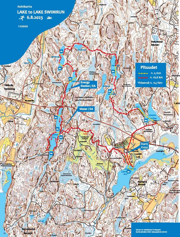
Reittikartta ja matkat / Course map and distances
Reitti on sama kuin vuonna 2016, jolloin kilpailu järjestettiin ensimmäistä kertaa. Viimeinen uintiosuutta selkeytettiin vuonna 2018.
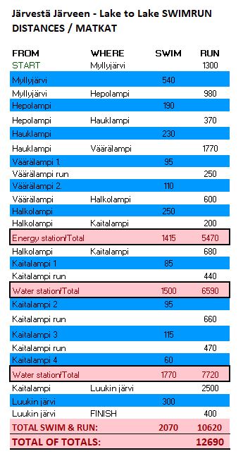
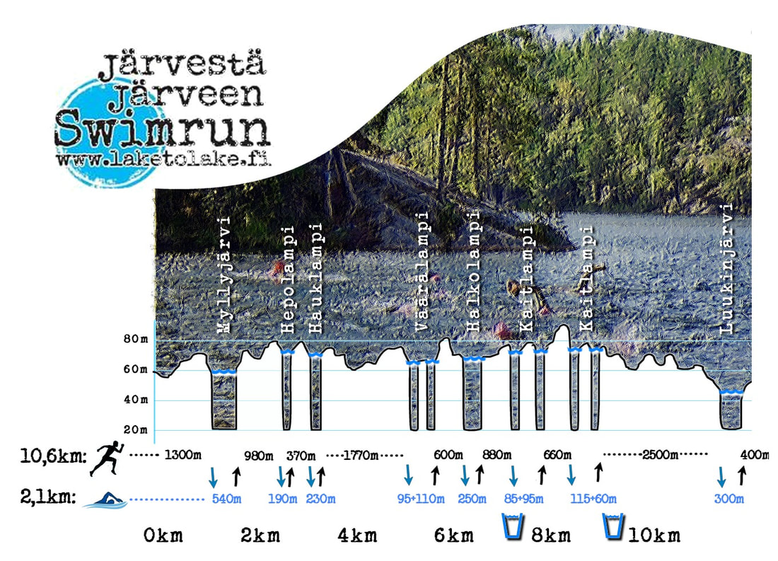
Reitti on n. 13km, josta uintia n. 2,1 km. Yksi yhtenäinen uintimatka maksimissaan n. 500m.
Pisin ja ensimmäinen uinti on 540m pitkä Myllylammen ylitys.
Koko radan uinnit sisältää 7 kpl järveä/lampea ja ylityksiä niissä yhteensä 11 kpl.
Reitti kulkee Luukin ulkoilualueelleen poluilla ja ulkoilualueen reittejä pitkin.
Reitin juoksuosuus on kokonaan viitoitettu! Viitoituksia on noudatettava - kartta sekä mitat ovat suuntaa antavia.
Uintiosuuksien alut ja loput merkitty myös maastoon näkyvin tunnuksin/lipuin.
Ohessa olevat reittipituudet ovat arviomatkoja.
in english
The course is same than 2016, when this race was arranged for the first time.
Course is about 13 km long with 2.1 km swim. Longest and the first swim is 540m long swim over Myllylampi.
There will be 7 lakes with 11 swim sections.
The course is located in the heart of Luukki outdoor recreation area. For the race the course is market and follows single tracks in the forest and partly recreation route which is covered in stone dust surface.
Swimrunners must follow the market route by organizers.
Attached in the map you can find the app. distances and sections of the race course.